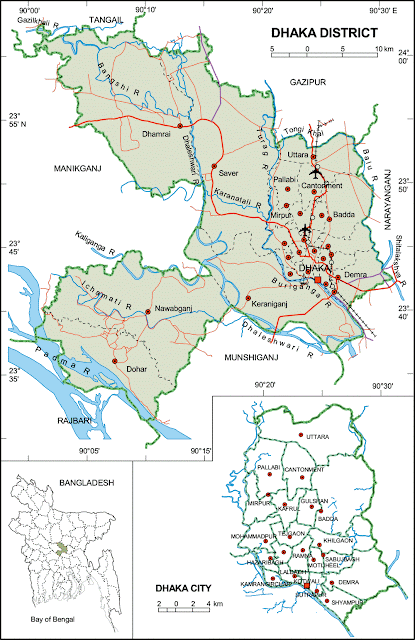
 Map of Dhaka District. Map of Dhaka City | Upazilas & Thanas:
|
Dhaka District (Dhaka division) with an area of 1463.60 sq km, is bounded by gazipur and tangail districts on the north, munshiganj and rajbari districts on the south, narayanganj district on the east, manikganj district on the west. Annual average temperature maximum 34.5°C, minimum 11.5°C; total rainfall 1931mm. Main rivers are Padma, Kaliganga, Dhaleshwari, Ichamati, Shitalakshya, Buriganga; small rivers are Bangshi, Turag, Balu, Elamjani, Alam, Bherujkha, Ramkrishnadi, Elisamari, Tulsikhali. Noted Beels Belai, Saldaher, Labandaher, Churain, Damsharan and Kiranjir Beel. | |