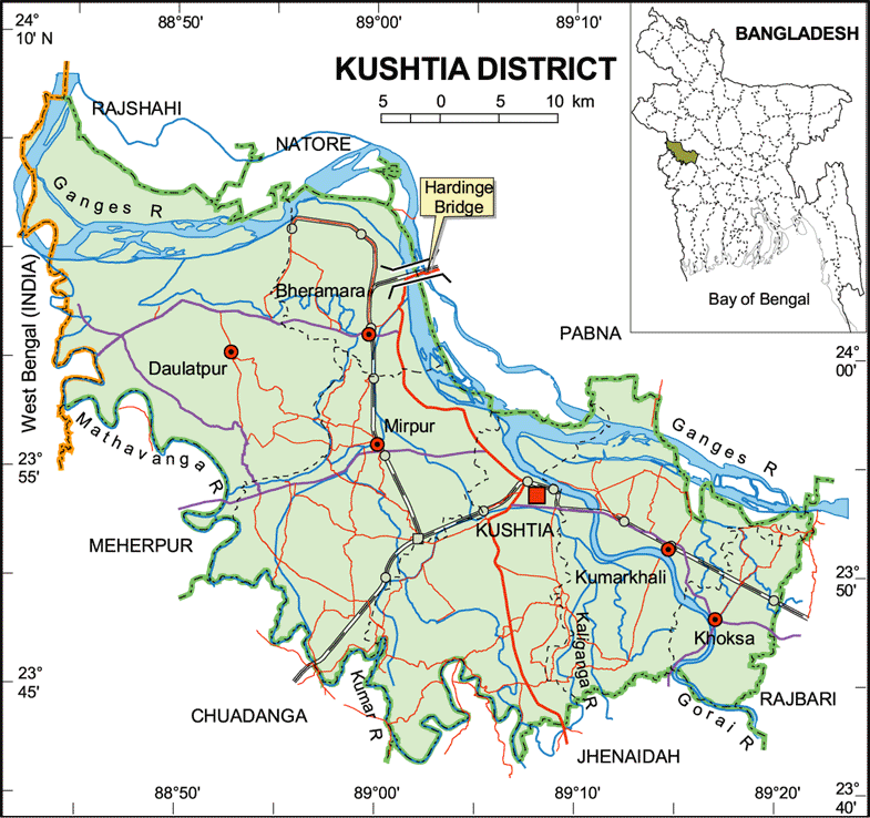
 Map of Kushtia District. | Upazilas & Thanas: |
Kushtia District (Khulna division) with an area of 1621.15 sq km is bounded by rajshahi, natore, pabna districts on the north, chuadanga, Jhenaidah districts on the south, rajbari districts on the east, West Bengal of India and meherpur district on the west. Main rivers are Ganges, Garai, Mathabhanga, Kaliganga and Kumar. Annual average highest temperature 37.8ºC and lowest 11.2ºC; annual rainfall 1467 mm. | |